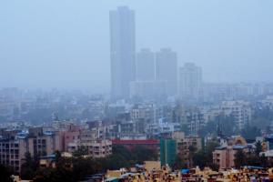
With heavy rain expected to inundate low-lying areas, citizens have been asked to stay indoors

The city started experiencing rainfall induced by the cyclone on Tuesday. Pic/Nimesh Dave
Cyclone Nisarga is expected to make landfall as a 'severe cyclonic storm' 95 km away from Mumbai near Alibaug on Wednesday between 2 and 3 pm. With strong, high-speed winds and heavy rain that's expected to inundate low-lying areas, citizens have been advised to remain indoors as city braces for possible damages due to the storm.
The Indian Meteorological Department (IMD) has issued a Red Alert for all three districts, which will continue through Wednesday. The city will start experiencing strong winds and rain from 10 am, which will subside after 5 pm. The winds will die down after 7 pm and rain shall remain.
ADVERTISEMENT
Major damages are expected to huts and houses with thatched or kucha roofs. Rooftops may blow off, unattached metal sheets may fly, power and communication lines may face problems.
There will be damage to roads as escape routes of water are expected to experience flooding. Other damages may include tree falls, uprooting of large avenue trees, damage to coastal crops and embankments for salt pans. IMD Mumbai has issued a warning for total suspension of fishing operations and movement in motorboats and small ships.
"The deep depression over East Central Arabian Sea moved northwards with a speed of 11 kmph and intensified into the cyclonic storm Nisarg. It is very likely to intensify into a severe cyclonic storm during the next 12 hours. It is very likely to move nearly northwards during the next few hours and re-curve north-eastwards thereafter and cross the coast of north Maharashtra and adjoining south Gujarat between Harihareshwar and Daman, close to Alibag and Raigad district on Wednesday afternoon with a maximum sustained wind speed of 100 -110 kmph, gusting to 120 kmph," said Shubhangi Bhute, a scientist at the IMD, Mumbai. Light to moderate rainfall at most places, heavy to very heavy rainfall at a few places, and extremely heavy rainfall (more than 20 cm in 24 hours) at isolated places is expected in north Konkan and north Maharashtra. "Storm surge of about 1 to 2 metres height above astronomical tide is very likely to inundate low lying areas of Mumbai, Thane and Raigad districts. Low-lying areas of Ratnagiri are expected to experience a storm surge of 0.5 to 1 metre height above the astronomical tide during landfall," added Bhute.
Mahesh Palawat, the chief meteorologist at Skymet Weather Services, a private agency, said, "The landfall is expected in north of Mumbai by afternoon or evening. The cyclone will weaken by June 4. It is not expected to have any impact on monsoon." However, wind speeds are going to be very high, as a result of which, sea conditions are going to be very rough.
5pm
Time after which wind speed and rainfall will reduce
Catch up on all the latest Mumbai news, crime news, current affairs, and a complete guide from food to things to do and events across Mumbai. Also download the new mid-day Android and iOS apps to get latest updates.
Mid-Day is now on Telegram. Click here to join our channel (@middayinfomedialtd) and stay updated with the latest news
 Subscribe today by clicking the link and stay updated with the latest news!" Click here!


