


mid-day took a test-drive to see if eForestrails — a GPS-based nature tour app that offers running audio commentary of three trails in the Sanjay Gandhi National Park — lives up to its ingenuity

We had been waiting for this moment since the day we heard about the launch of a Cellphone Nature Tour of the Sanjay Gandhi National Park (SGNP). So, when we spotted the eForestrails app on the Google Play Store last Sunday, the next obvious step was to test it for ourselves.
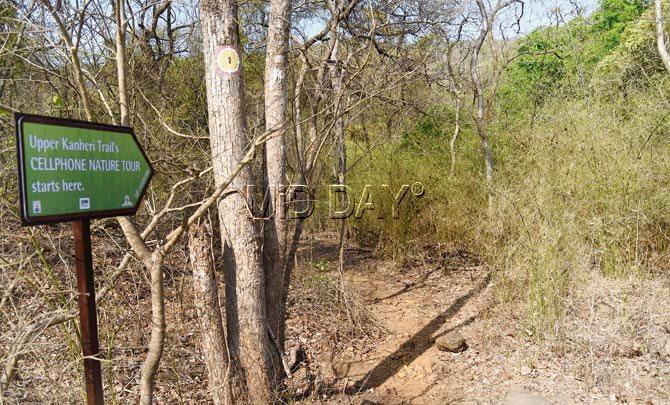
A signboard announcing the starting point of the Upper Kanheri Trail. We missed it entirely as it was placed on the inside. A signboard near the main road would have been more helpful. Pics/Nimesh Dave
ADVERTISEMENT
So, a day later this reporter and mid-day photographer Nimesh Dave reached the doors of SGNP, armed with mobile phones, cameras and a power bank.
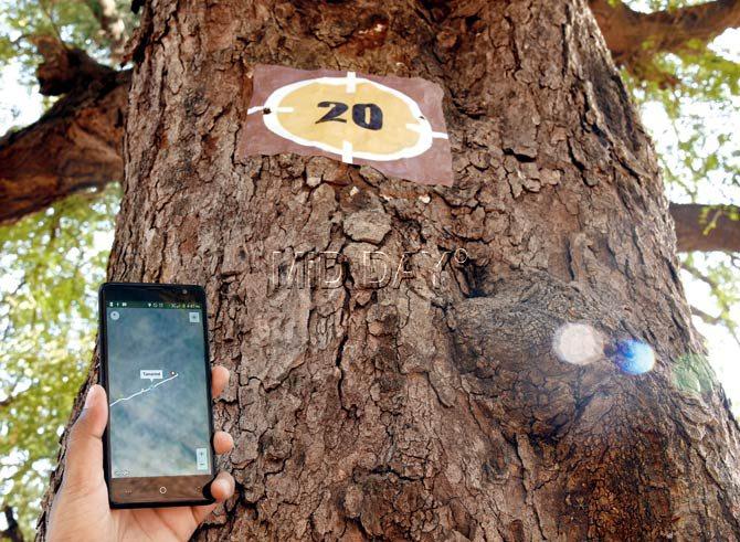
The last waypoint as part of the 1.3 km-long Avenue Trees Trail is a tamarind tree (number 20). The trail concludes at Chinch Pada inside the park
What’s the app about?
eForestrails is an Android app which allows the user to take a GPS-based Cellphone Nature Tour of three trails in SGNP. Created by Ladybird Environmental Consulting, the app is available for free download and offers an audio-visual guide through three trails — Avenue Trees Trail (1.3km), Bamboo Hut Trail (1.4 km), and Upper Kanheri Trail (1.2km).
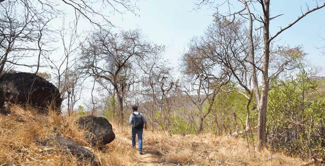
We try to get back into the trail as we lost our way in the woods
Each trail, with 20 waypoints (points of interest), is GPS-tagged on a map in the app (and numbered on the actual site) that you track using GPS. During the trail, you can either listen to audio commentary about a waypoint or read a text description of the same along with images.
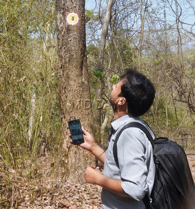
Each waypoint is numbered, which is used to identify it on the app. This is the third waypoint as part of the Upper Kanheri Caves, which is identified as the Malabar Kino (bibla) tree. The bibla is a leguminous plant and helps increase the nitrogen level in the soil. It also turns water blue as soon as it comes in contact with it
What we liked
The three trails offer a mix of choices for nature lovers. Those looking for an easy walk can try the Avenue Trees Trail, a 1.4 km walk with easy difficulty that starts near the gate at SGNP and ends at Chinch Pada, offering a glimpse at some 20-odd trees right from the medicinal Red Silk Cotton Tree to Sandpaper Tree and Fish Tail Palm, ending at a Tamarind tree near the shelters at Chinch Pada.
Each of these trees are marked with a number, which can be used as a reference point to find more details about them on the app. You can either read a description and see images or listen to an audio commentary. We enjoyed all of them. The same features are present in the other two trails — Bamboo Hut Trail and Upper Kanheri Trail, which come with a medium rating in terms of difficulty.
The trail is GPS-mapped, so once you are on it, you can simply follow it to find the various waypoints along the trail.
What we didn’t like
Despite the ease in identifying the Avenue Trees Trail, we had no such luck with the Upper Kanheri Trail and the Bamboo Hut Trail.
The GPS works fine, but there are no physical signboards on the main road in the park to help you locate the starting or end points of the trails. And if you are new to the park, you may not be able to place the same. We could not find the Bamboo Hut Trail till the end, and missed the starting point of the Upper Kanheri Trail, only to take a round about route (which included an hour of tiring climb) and returned without any success. When we did find the Upper Kanheri Trail, and later the Avenues Tree Trail, we couldn’t figure some of the waypoints along the route.
At one point, it felt like playing a treasure hunt, which we wouldn’t mind were there more clues on the app. Some of the numbers were hidden behind the foliage, and were not visible even in broad daylight; we expect things to get harder once the monsoon sets in.
eForestrails could do a lot better with some improved navigability within the app. Instead of going back and forth to each waypoint, we would rather have it take us automatically to the next way point and back, based on our GPS location or at least offer an option for it.
Also, the app allows you to do only one thing at a time. You can either watch the pictures or listen to the commentary, which breaks the momentum. Ideally, we would have preferred that all the elements work in sync on a single page, or at least a scenario where accessing pictures or text does not affect the audio commentary.
Our verdict
The app is a great attempt, no doubt, in using technology to create awareness about nature.
And it has succeeded in achieving its core goal — which is to offer an audio-visual cellphone-guided experience of a few interesting trails inside SGNP.
We would love to return, perhaps, with a larger group.
However, it’s equally important to mark the spots with physical signboards (visible to passer bys) as is to geo-tag them. Until that happens, we would advise our readers to skip the inner trails (Upper Kanheri Trail and Bamboo Hut Trail) if they are going solo, unless a person who is familiar with the territory accompanies them.
As it happened with us, we were almost lost in the jungle as we went off the trail.
Lastly, don’t forget to bring a power bank along, since the app relies on GPS, which consumes a lot of battery.
 Subscribe today by clicking the link and stay updated with the latest news!" Click here!
