That sinking feeling
Updated On: 01 December, 2019 07:00 AM IST | Mumbai | Sumedha Raikar Mhatre
Students of the School of Environment and Architecture deconstruct climate, terrain and habitation of Mumbai's R Ward in a pilot project that looks at the city's flooding nightmare every monsoon





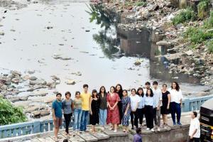
The group of architecture students, who conducted the study, gather on the bridge near the Borivli BMC office along the Dahisar river. Pic/Satej Shinde
 On a rainy day in 2051, when the mean sea level will rise by 0.5 metres, nearly 23 per cent of the urbanised areas of Borivli or R Ward, will be underwater. This will endanger the life of one in every five slum dwellers and one in seven residents overall. Going by the current habitation practices in Borivli, ongoing infrastructure projects, clogged drainage and outfalls into nullahs and the sea, there is likely to be an added reverse flow of water into the mainland. The scenario will be similar to what we witnessed on August 29, 2017, after 500mm rainfall.
It sounds like a doomsday prophecy, but is a prediction based on the Intergovernmental Panel on Climate Change (IPCC) report, which projects a 1.1 metre sea level rise for the year 2100. It's part of a homegrown pilot study executed by the final year students of the School of Environment and Architecture (SEA), in Borivli. The study, encapsulated in the book, Of Land Or Water?, focuses on the swatch extending from the foothills of Sanjay Gandhi National Park to the Manori creek. But its research methodology and perspective applies to all of Mumbai, a city that has seen an average of 250mm rainfall per day in the last six years.
Trending Stories
Latest Photos
Latest Videos
Latest Web Stories
ADVERTISEMENT
Mid-Day Fast
ADVERTISEMENT