


A fascinating exhibition presents ancient maps of India that speak as much of its changing geography, as a conservation effort that turned brittle antique records into grand displays

The Gulf of Cambay, now known as Gulf of Khambhat, is a bay on the Arabian Sea coast bordering Gujarat
For over two centuries, The Asiatic Society of Mumbai has been known for its collection of historically significant books and documents. Among its archives sits another treasure—rare vintage maps that document the visual artistry of cartographers and their composition of India through the ages.
This month, with the help of the Rotary Club of Bombay, a selection of 30 maps will be displayed at an exhibition titled Meandering Through a Mapped Canvas. Vispi Balaporia, president, The Asiatic Society of Mumbai, says this was long in the offing. “The idea was mooted five years ago by the-then secretary of the Ministry of Culture. The first step was finding an expert cartographer, which wasn’t easy, and, unfortunately, a large part of this collection was tucked away in the basement where we occasionally end up ‘discovering things.’”
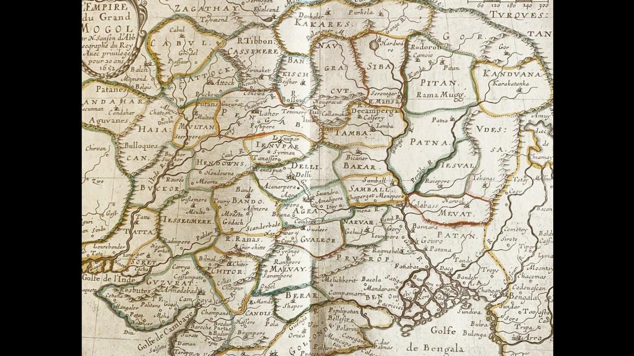
L’empire du Grand Mogol (Map of the Great Mughal Empire) by Nicolas Sanson is the oldest in the exhibition
Deepti Anand, curator and co-founder of Past Perfect, a heritage management company, who partnered on the project, adds, “The conservation process ends up feeling like a game of jigsaw; we piece together tiny scraps and bits. These maps are extremely fragile pieces and since they were meant to be on display for a month, they had to be sturdy enough to hold up and be legible for viewing.”
Selected based on diversity, these maps span 300 years, with the oldest dating back to 1652 and titled L’empire du Grand Mogol (Map of the Great Mughal Empire) by Nicolas Sanson D’abbeville. Every early map begins to present a vague idea of India—geographically very different from what we’re used to seeing—because, back then, people didn’t know exactly what they were mapping. “Early cartographers didn’t have the modern tools to create a map like the one we are familiar with. The ideas were more primitive. In some cases, you will notice The Ganges in the centre of the country, as it was believed to be back then. A lot of mapping was also based on travellers’ accounts,” illustrates Anand.
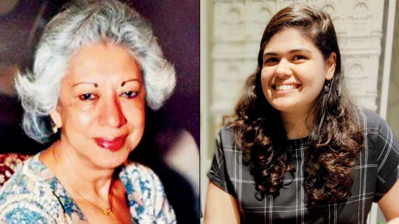
Vispi Balaporia and Deepti Anand
While it’s amusing to notice the ad-libbed spellings and haphazard geography from centuries ago, you are likely to be awestruck with the intricacy that went in, with no modern technology to spare. The Great Trigonometrical Survey of India which comprises 24 pieces documented between the 1840s to the 1860s is one of the most detailed charts of the country to date, with fascinating topographical details. Through mathematical experiments across the country creating triangles with trigonometry, it set out to prove that the Earth is, in fact, spherical. This process ended up creating a map of India and a revolution in Indian geography.
But restoring antique paper or any material for a showcase of this scale, comes with its own challenges, say the organisers. Conservation consultant Amalina Dave explains, “Conservation is complex, but it asks a rather simple question—have we done what was in our power to extend the lifespan of an object? From extreme brittleness and fragmentation to staining, crumpling, and water and mould damage—the diverse materiality and conditions of the maps required adapting methods, techniques, and approaches for their restoration. Each map tells a different conservation story, a series of choices and multiple processes so that they could be viewed and enjoyed by the generations to come.”
WHAT: Meandering Through a Mapped Canvas
WHEN: Till April 30
WHERE: Asiatic Society of Mumbai, Horniman Circle
CALL: 22660956
 Subscribe today by clicking the link and stay updated with the latest news!" Click here!


