

To keep real-time tab on destruction of Mumbai's crucial wetlands, deliberate fires and unauthorised construction, civic body to source high-resolution geospatial content from American firm

In a first-of-its-kind initiative to prevent illegal activity in Mumbai's eco-sensitive zones, the BMC has tied up with Indian Space Research Organisation (ISRO) to monitor these areas closely, using satellite images.
The programme will be facilitated by National Remote Sensing Centre (NRSC), a department of ISRO. The NRSC, which deals with the acquisition and processing of remote-sensing satellite data, will be sourcing the images through American company Digital Globe. The project is likely to be launched next month.
Confirming the development, Additional Municipal Commissioner Idzes Kundan, who is spearheading the project, said, "It is crucial to keep an eye on encroachment and illegal activity in the mangroves. The objective is to keep a vigil. Instead of acting on a complaint after it (illegal activity) has happened, we would like to take action while it is happening," she said.
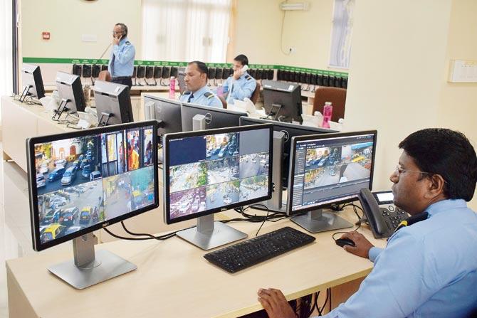
The BMC will also launch a 24/7 helpline at its Lower Parel Disaster Mgmt Cell, which will address civic complaints in three hours flat. A feedback of the action taken will be sent to the complainant's mobile number. Pic/Ashish Raje
How it works
Civic officials involved in the project said that the monitoring will be done with the help of change detection reports. "The satellite images will be taken regularly with a 24-hour lag period. The data will be processed using the base maps as reference. The system is able to detect any deviations in the image and the base map; this could include illegal activities like deforestation or dumping of debris in the mangrove patch. A notification will then be sent to us and we will alert the department concerned, be it forest department or the mangrove cell," said an official involved in the project. Procuring these images and reports will cost the BMC around Rs 3 to 4 crore per annum.
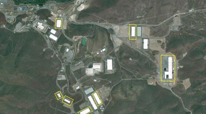
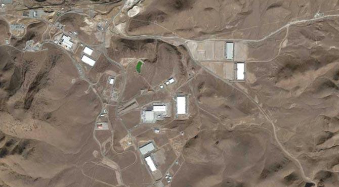
(Top) Representational maps from Digital Globe indicate how any change (yellow boxes indicate new construction) on the base map (below) will be monitored every 24 hrs
Digital Globe will first process and hand over the images to NSRC, which will then share it with the BMC. When asked how these images would be different from those available on Google Earth, an official from Digital Globe explained that Google also buys the satellite images from their company, but the data on their maps is updated only once every three months and is primarily used for navigation purposes.
"We take imagery from different spectral bands and then do an image-analysis and develop algorithms to give a scientific analysis of how the bio-masses [like mangroves] have changed," the official said. The official added that the images will have a resolution of 30cm. "This means that from the satellite we will be able to measure any object, which is 30 cm or more."
Activists still cynical
Environmentalists and activists who have been fighting to save Mumbai's eco-sensitive zones felt that the initiative had potential, but remained cynical of its results.
Shruti Agarwal, who along with her husband Sunil, has been fighting to prevent construction activity on a 80-acre wetland patch in Talawe, Navi Mumbai for a golf course - it could render several migratory birds homeless - said, "We need urgent intervention. Development cannot be at the cost of destroying forest areas."
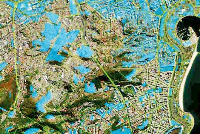
The satellite images will be scientifically analysed to check if the bio-masses - like mangroves and forest cover - have changed. Pic Courtesy/DigitalGlobe.com
Stalin Dayanand, environmentalist and director of NGO Vanashakti, and member of the Aarey Conservation Group, added, "It is very encouraging to see that the BMC is trying to monitor green zones. However, the new Development Plan is a classic case of the right hand not knowing what the left is doing. Aarey colony has been declared as an eco-sensitive zone and is out of bounds for construction. But, if the planning authority is sanctioning townships [for the tribal community in Aarey], it's a complete mockery," he said.

Idzes Kundan, Additional municipal commissioner
Rishi Aggarwal, a social-environment activist and Observer Research Foundation fellow, pointed out that though the initiative can help with early detection of illegal activities, the BMC should also focus on what to do with that information, once they have it. "Real-time monitoring is a positive step. However, government bodies cannot act alone and the BMC has to think about what can be done to deter people," he said.
Rishi Aggarwal, Social-environment activist
N Vasudevan, additional principal chief conservator of forest and mangroves, said that there is no alarm concerning the city's green cover. "In 2013, the mangrove cover [in the city] was spread out over 43 sq km, which increased to 48 sq km in 2015 and then 64 sq km in 2017 due to the efforts that we have taken over the years. Now, that the BMC is monitoring eco-sensitive areas, we will get alerts on a regular basis," he said.
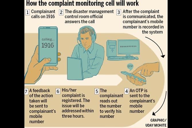
Cell to tackle civic woes
In order to address the flood of complaints it receives on a daily basis, the BMC will be launching an active complaint monitoring cell next month. Complainants will be able to reach the cell on the 24/7 helpline number 1916. After the complaint is communicated, the complainant's mobile number will be recorded in the system, and an OTP will be sent to verify it. Once the complaint is registered, the concerned official will be expected to address the issue within three hours. A feedback of the action taken will be also be sent to complainant's mobile number. Anil Joseph, chairperson of the Perry Roads Residents Association, said, "Anything that is more interactive and convenient for citizens to file a complaint is a good initiative."
Catch up on all the latest Mumbai news, crime news, current affairs, and also a complete guide on Mumbai from food to things to do and events across the city here. Also download the new mid-day Android and iOS apps to get latest updates
 Subscribe today by clicking the link and stay updated with the latest news!" Click here!


