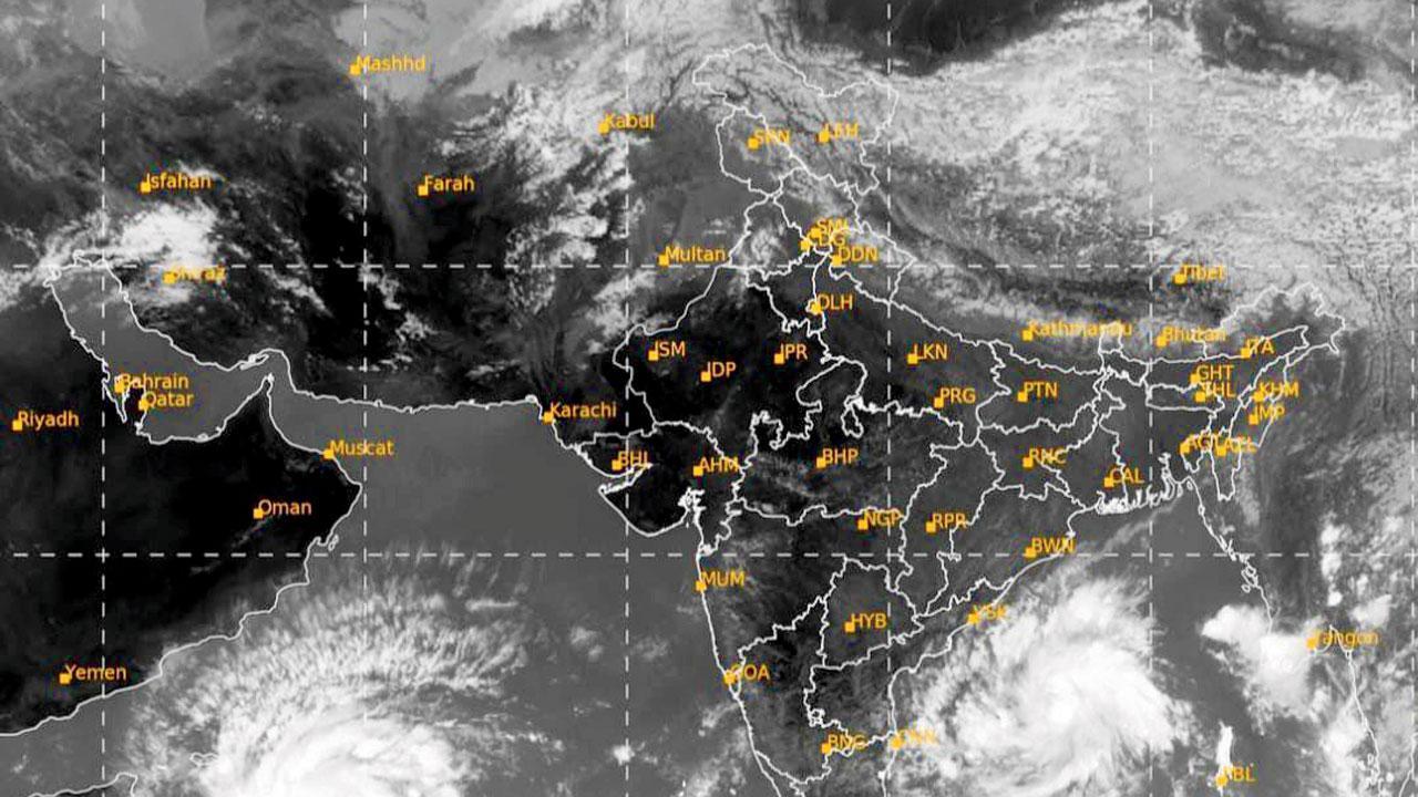
With two cyclonic systems brewing in the Arabian Sea and the Bay of Bengal, experts say no imminent danger for those living on the coasts

According to meteorologists, the two storms, when formed, will be separated by a large distance, in excess of 2,500 km
Even as two cyclonic systems are developing in the Arabian Sea and the Bay of Bengal, evolving into twin tropical storms, meteorologists and climatologists say there is no reason to panic. According to meteorologists, these systems are anticipated to progress without significantly impacting the entire western coast, including Mumbai and other regions of Maharashtra.
As per the India Meteorological Department (IMD), a low-pressure area over the southeast and southwest Arabian Sea had evolved into a depression, approximately 920 km east-southeast of Socotra (Yemen), 1,190 km southeast of Salalah airport (Oman), and 1,280 km east-southeast of Al Ghaidah (Yemen).
“The system is anticipated to maintain its west-northwestward trajectory and intensify into a cyclonic storm within the Southwest Arabian Sea. As it continues, it is projected to escalate into a severe cyclonic storm by the evening of October 22. Subsequently, from the morning of October 24, it is expected to shift its course towards the north-northwest, heading in the direction of the southern coasts of Oman and adjacent Yemen.”
A meteorologist from Skymet weather, a private weather forecasting agency, said the depression in Arabian sea is likely to intensify fast into a cyclonic storm named Tej. “It is expected to make a landfall [along the Yemen coast] around late night on October 23 or early October 24.” Meanwhile, the likelihood of the Bay of Bengal hosting a storm is also increasing. There are signs of this cyclonic system developing into a storm, sometime around October 24. This storm, if developed, will be named Hamoon. The two storms, when formed, will be separated by a large distance, in excess of 2,500 km.
Also read: Mumbai: Six main accused emerge in police’s 3,420-pg chargesheet
Experts said that Mumbai is in no imminent danger. “The Arabian Sea system is facing stiff resistance from the anticyclone [high pressure] in the North Arabian Sea, hence, as mentioned, is continuing to move westwards towards Oman. This will keep our western coast free from danger,” said the meteorologist, “Mumbai will continue to be stuffy and warm. Weather will improve to comfort levels after the effect of winds will change post October 25,” said climatologist Rajesh Kapadia of Vagaries of Weather, a popular private weather blog.
 Subscribe today by clicking the link and stay updated with the latest news!" Click here!


