Officials say complaints of minor slides and rockfalls have increased exponentially since a vulnerability study was conducted in 2018, a GSI report stated

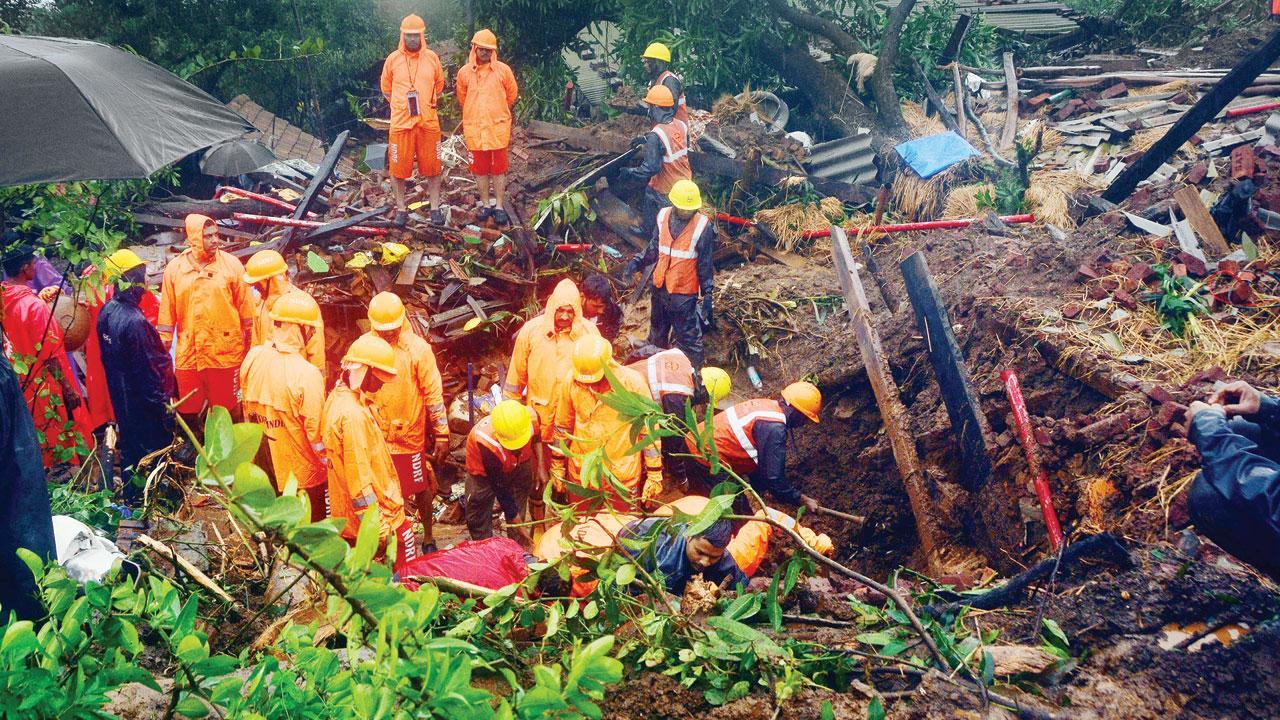
Rescuers carrying out search operations at the landslide site. File pic/Satej Shinde
In the aftermath of the devastating landslides that struck Irsalwadi in Khalapur and Taliye Varcha Aawad in Mahad, both villages located in the Raigad district, officials have become concerned. The landslides occurred on July 19, 2023, claiming 84 lives in Irsalwadi and on July 22, 2021, resulting in the deaths of 87 people in Taliye. Worryingly, neither village was included on the list of nine high-risk landslide-prone villages out of the 103 in the Raigad district.
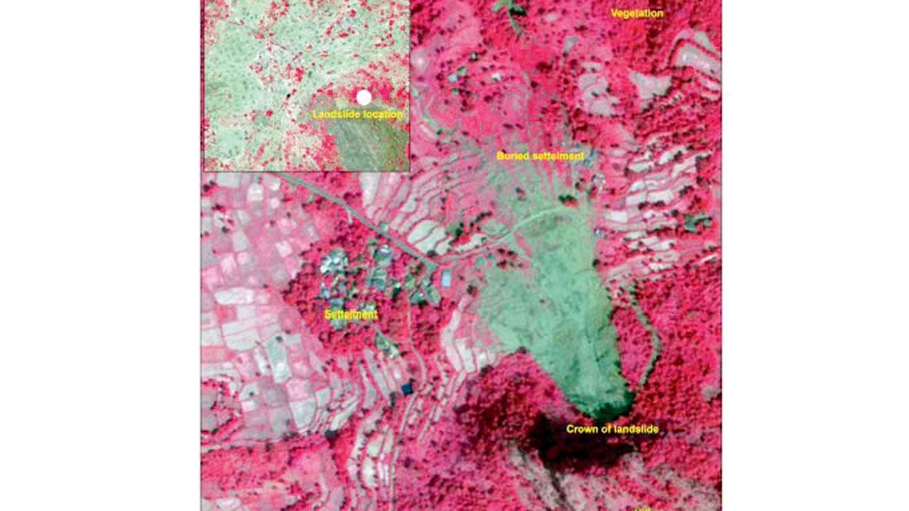
According to the National Remote Sensing Centre (NRSC) of ISRO, Hyderabad, their latest Landslide Atlas of India, published in 2023, featured before and after satellite images of Taliye village, Mahad. The images captured on April 20, 2021, and October 15, 2021, respectively, provided a clear picture of the catastrophic landslide’s impact, showing rotational and deep translational failure along the main body of the landslide crown. Dr Yogesh Mhase, district collector, Raigad, confirmed the exclusion of both Taliye Varcha Aawad and Irsalwadi from the highly vulnerable category in the GSI report of 2018.

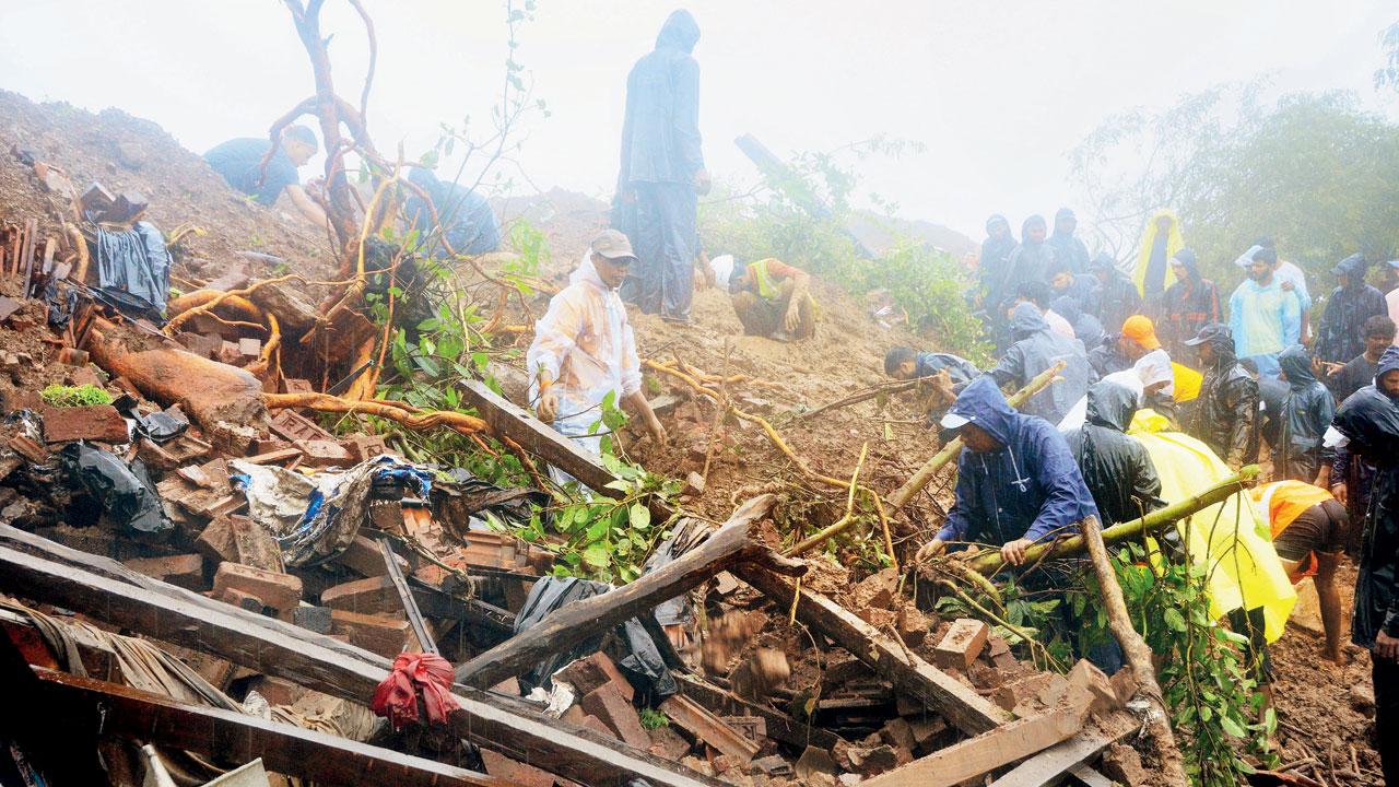
The site of the landslide last month. Pic/Satej Shinde
Dr Mhase explained the findings of the GSI report from 2018. According to the report, there were a total of 103 villages prone to landslides in Raigad district, classified into three categories: class-1 (highly vulnerable: nine villages), class-2 (moderately vulnerable: 11 villages), and class-3 (less moderate: 83 villages). Nine villages fell into the highly vulnerable category, and appropriate measures were taken to relocate them. Class-2 villages were temporarily shifted, while class-3 villages were closely monitored.
The collector stated that they have received complaints from many more villages in the district regarding minor landslides and falling rocks from the hills. These complaints have been increasing in the last five years since the last report in 2018. Regarding the need for an extensive study, Dr Mhase stated, “I will soon be writing to GSI authorities and will be asking that an extensive study be conducted on the entire hamlets located on the hilly regions of the district along with their livestock and proper GI mapping be done of these locations so that we are not missing out on any data of human habitat in these hill regions.”

Satyajit Bade, the additional CEO of zilla parishad, Raigad; Dr S A Patil, a geoscience expert and head of MRSAC
Shifted 883 people
Satyajit Bade, the additional chief executive officer of zilla parishad, Raigad, said that around 883 people from 20 villages in Mahad and Mangaon talukas have already been relocated to safer locations in the baseline areas for a fortnight and they have now returned to their original hamlets. He said, “The district administration provided them with basic infrastructure and ration that was required for habitat at the temporary shelter.”
Different studies
A senior geoscientist explained that different studies, such as landslide susceptibility and landslide vulnerability, use different parameters to map the areas.
Why not on list
“In the case of both Taliye and Irsalwadi, the villages were located on flattish land or very gentle ground away from main hill slopes, hence these particular village areas were not identified under susceptible/vulnerable zones. However, the main hill slopes behind these villages where landslides actually initiated were identified as susceptible areas, any village located on flat/gentle ground and 100 to 200 metres away from the main hill slopes usually do not fall under the vulnerable category as per methodology,” explained the geoscientist.
 Landslide atlas
Expert speak
Dr S A Patil, a geoscience expert and head of Maharashtra Remote Sensing Application Centre (MRSAC), Pune office, shed light on the geological factors contributing to the landslides in the western ghats. He said, “We have to understand that the mountains on the western ghats have existed for over 66 million years and are results of volcanic eruptions caused then when lava began to extrude through fissures in the crust known as fissure eruptions. The western ghats have hard rocks of Deccan Basalt.”
He emphasised that the western ghats’ steep-sloped cliffs and high-degree slopes undergo extensive weathering due to direct exposure to extreme climatic conditions, including heavy rainfall during the monsoon, colder weather in winter, and intense sunlight in summer. This exposure leaves the areas vulnerable to landslides due to a phenomenon called ‘Solifiction,’ where wet soil and other materials gradually move down slopes, especially where compact rock and subsoil hinder water percolation.
Dr Patil also emphasised the need for all stakeholders, including the National Remote Sensing Centre (NRSC), MRSAC and Geological Survey of India, to conduct large-scale studies using the latest geo-spatial technologies to identify vulnerable areas and move inhabitants from these foothills to safer locations, as the probability of landslide recurrence happening after every few years cannot be ruled out.
Recommendations
The GSI report made several recommendations, including no further hillward cutting in the back slope, proper drainage arrangements with catch drains and contour parallel drains towards the hillside, provision for catch ditches and awareness towards the development of any slope instability during the rainy season. The removal of loose rock blocks from back slopes and the prohibition of further cutting or anthropogenic activities in vulnerable areas were also recommended.
 Subscribe today by clicking the link and stay updated with the latest news!" Click here!


