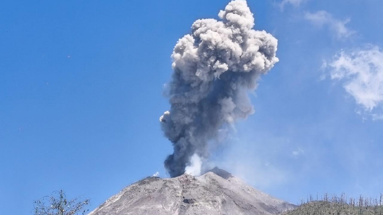
The cloud, carried by strong upper-level winds, passed over Gujarat, Rajasthan, northwest Maharashtra, Delhi-NCR, Haryana and Punjab, before gradually moving towards the Himalayas

Pic/AFP
A rare volcanic eruption in Ethiopia on Sunday sent a massive ash plume soaring high into the atmosphere and drifting thousands of kilometres across the Middle East before entering India on Monday evening.
The cloud, carried by strong upper-level winds, passed over Gujarat, Rajasthan, northwest Maharashtra, Delhi-NCR, Haryana and Punjab, before gradually moving towards the Himalayas. Authorities briefly monitored the situation for possible aviation disruptions, while the India Meteorological Department (IMD) assured that conditions would normalise by Tuesday evening.
Here’s a detailed explainer on what the volcanic ash is, how it travelled to India, which regions were affected, and when the impact will fade.
What is the Ethiopian volcanic ash?
The ash originated from the Hayli Gubbi volcano, located in Ethiopia’s Afar region near the Red Sea. The volcano—dormant for nearly 10,000 to 12,000 years—erupted explosively on Sunday morning.
Unlike lava-flow eruptions, this one was dominated by:
Volcanic ash (fine fragments of pulverised rock and glass)
Sulphur dioxide (SO2) and traces of carbon dioxide
Very fine particles capable of rising to altitudes of 15–14 km (45,000 ft)
Thicker or heavier particles fall near the eruption site. But very fine ash and gases get lifted high into the atmosphere as hot air from the eruption column rises vertically at great speed.
At these heights—15 km and above—powerful jet-stream winds quickly disperse the ash horizontally across continents, allowing the plume to travel over vast distances without falling to the ground.
The Hayli Gubbi plume did exactly this: it rose high, remained suspended in upper air layers, and began drifting eastward alongside fast-moving winds.
How did the volcanic ash travel all the way to India?
Once the ash reached the upper troposphere and lower stratosphere, it was transported by strong high-level winds.
Tracking by the Toulouse Volcanic Ash Advisory Centre (VAAC) and IMD shows the plume’s journey as follows:
- Sunday (Ethiopia): Ash rose up to 14 km over the Afar region.
- Crossed the Red Sea: Winds carried the plume toward Yemen and Oman.
- Moved over the Arabian Sea: Jet streams steered the cloud eastwards.
- Entered India around Monday evening: First sighted over Jamnagar (Gujarat) at ~5.30 pm.
- Shifted northeast: Passed over Rajasthan, northwest Maharashtra, Delhi-NCR, Haryana and Punjab by about 10 pm.
- Continued toward China: The ash cloud is expected to fully exit Indian airspace by 7.30 pm Tuesday, moving toward Tibet and western China.
The elevation of the plume—between 15,000 and 25,000 ft, rising to 45,000 ft in layers—placed it directly in typical long-distance flight corridors, prompting temporary air traffic advisories.
Which Indian regions were impacted?
While the ash remained far above ground level and did not pose a health hazard, its movement across western and northern India did affect flight planning.
IMD’s SIGMET (Significant Meteorological Information) bulletins indicated movement over:
- Gujarat
- Rajasthan
- Delhi-NCR
- Punjab
- Haryana
Parts of northwest Maharashtra
Skies appeared hazy or darker than usual in some pockets due to high-altitude scattering of sunlight, though this did not translate into poor ground-level air quality.
Impact on aviation
- Because volcanic ash can damage aircraft engines, sensors and filters, several precautionary steps were taken:
- Airlines altered flight routes and cruising altitudes.
- Some flights were delayed, diverted or cancelled (IndiGo cancelled six services).
- DGCA issued an advisory directing operators to avoid affected airspace and monitor VAAC bulletins continuously.
- Airports were told to inspect runways and aprons if any ash deposition was suspected, though none was reported.
- Notably, experts stressed that passengers faced no direct inhalation risk, as planes have highly sophisticated air filtration systems.
When will the volcanic ash lessen—and why the impact is short-lived
- Volcanic plume movement is typically a short-duration atmospheric event.
According to IMD Director General Mrutyunjay Mohapatra:
- The ash cloud is already drifting toward China.
- It will fully leave Indian skies by 7.30 pm on Tuesday.
- No significant ground-level accumulation is expected in India.
Why the impact fades quickly
- Fine ash particles disperse rapidly in the upper atmosphere and become too diluted to pose a threat.
- Wind shear and jet stream variations cause the plume to stretch and thin out.
- Clouds and rainfall further wash out residual ash.
- SO2 and CO2 emissions from this eruption are not high enough to meaningfully alter regional air quality or climate.
Should India worry?
No. The plume travelled at high altitudes, posing minimal risk to people on the ground. The primary concern was aviation safety, which was addressed through international and domestic advisories.
The eruption itself appears to have subsided, and forecasts show airspace normalisation within hours.
 Subscribe today by clicking the link and stay updated with the latest news!" Click here!


